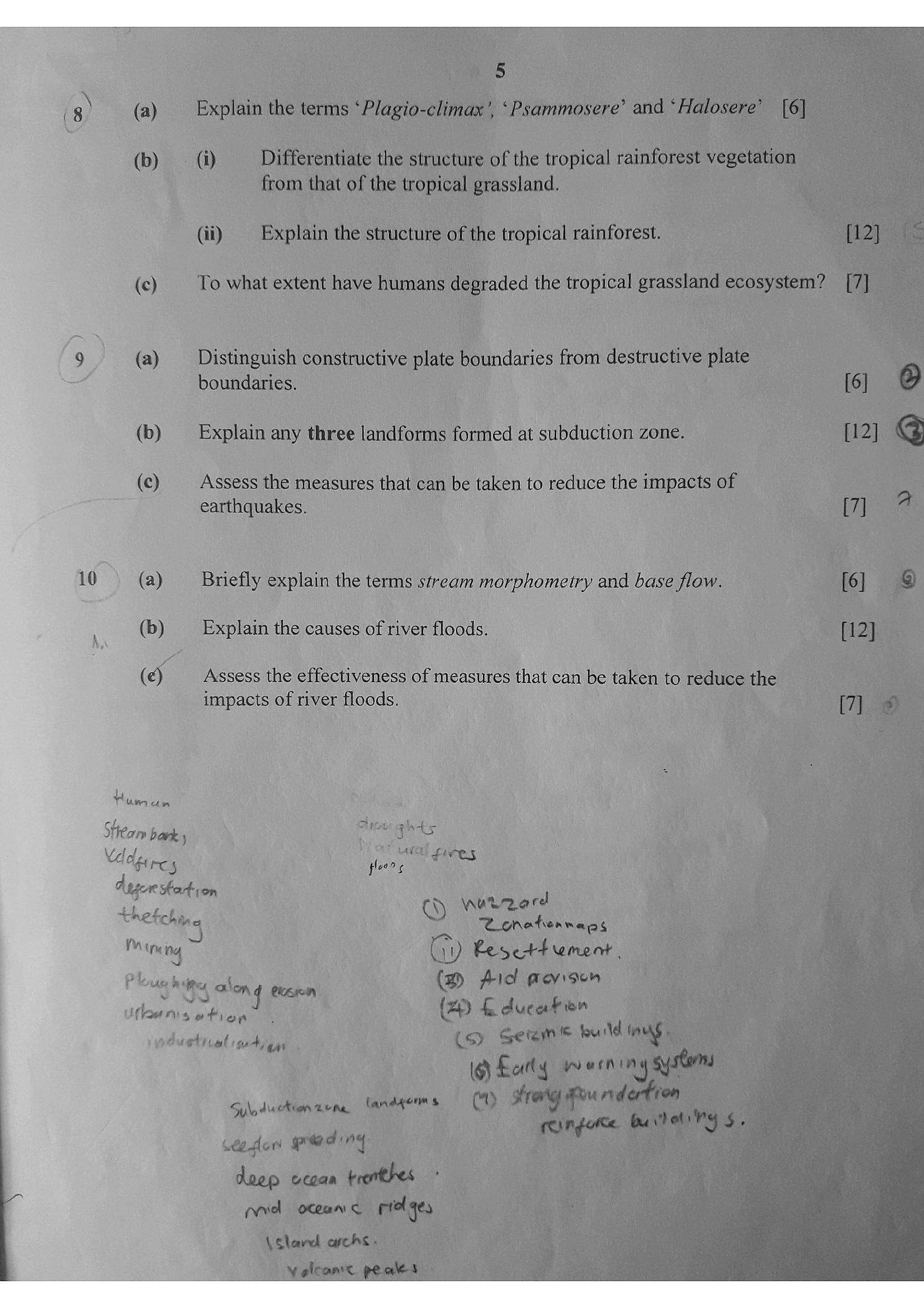
📄 Exam Questions & Readable Text Transcript
Full OCR-extracted text of questions, syllabus codes, and exam instructions.
Extracted Content: 2019_geo_alevel_mj_paper1
Page 1
Extracted Text
Fae DecfarmanZIMBABWE SCHOOL EXAMINATIONS COUNCIL
General Certificate of Education Advanced Level
GEOGRAPHY
PAPER | : PHYSICAL COMPONENT
-
6037/1
JUNE 2019 SESSION 3 hours
Additional materials:
Answer paper
TIME 3 hours
INSTRUCTIONS TO CANDIDATES
Write your name, Centre number and candidate number in the spaces provided on the answer
paper/answer booklet.
Answer any four questions in this paper.
Write your answers on the separate answer paper provided.
If you use more than one sheet of paper, fasten the sheets together.
INFORMATION FOR CANDIDATES
The number of marks is given in brackets [ ] at the end of each question or part question.
Sketch maps and diagrams should be drawn wherever they serve to illustrate an answer.
You are reminded of the need for good English and clear presentation in your answers,
This question paper consists of 5 printed pages and 3 blank pages.
Copyright: Zimbabwe School Examinations Council, 2019.
ZIMSEC J2019
& {Turn over
---
Page 2
Extracted Text
---
Page 3
Extracted Text
8)Q) (a) Briefly define the terms rainfall intensity, infiltration capacity and (6)
stemflow. geryrd fare
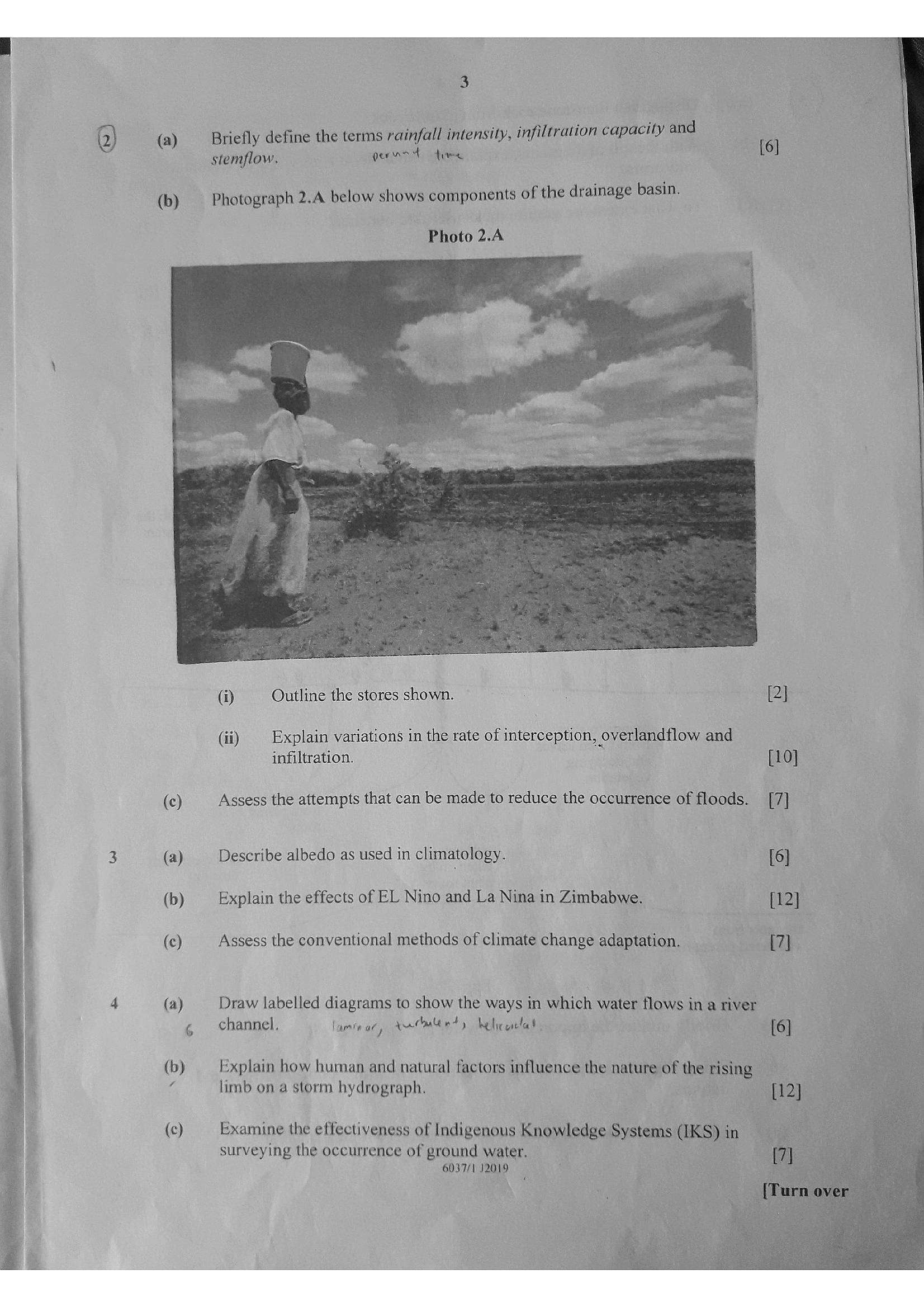
(b) Photograph 2.4 below shows components of the drainage basin.
Photo 2.4
i Outline the stores shown. : [2]
i)
(ii) Explain variations in the rate of interception, overlandflow and
infiltration. [10]
(c) Assess the attempts that can be made to reduce the occurrence of floods. [7]
3 (a) Describe albedo as used in climatology. (6)
(b) Explain the effects of EL Nino and La Nina in Zimbabwe. {12]
(c) Assess the conventional methods of climate change adaptation. [7]
4 (a) Draw labelled diagrams to show the ways in which water flows in a river
¢ channel. laminar, Antmteet ys belicaetat {6]
(b) Explain how human and natural factors influence the nature of the: rising
4 limb on a storm hydrograph.
(c) Examine the effectiveness of Indigenous Knowledge Systems (IKS) in
surveying the occurrence of ground water.
6037/1 J2019
---
Page 4
Extracted Text
(ale (b)(ee
(a)
(b)
(c)
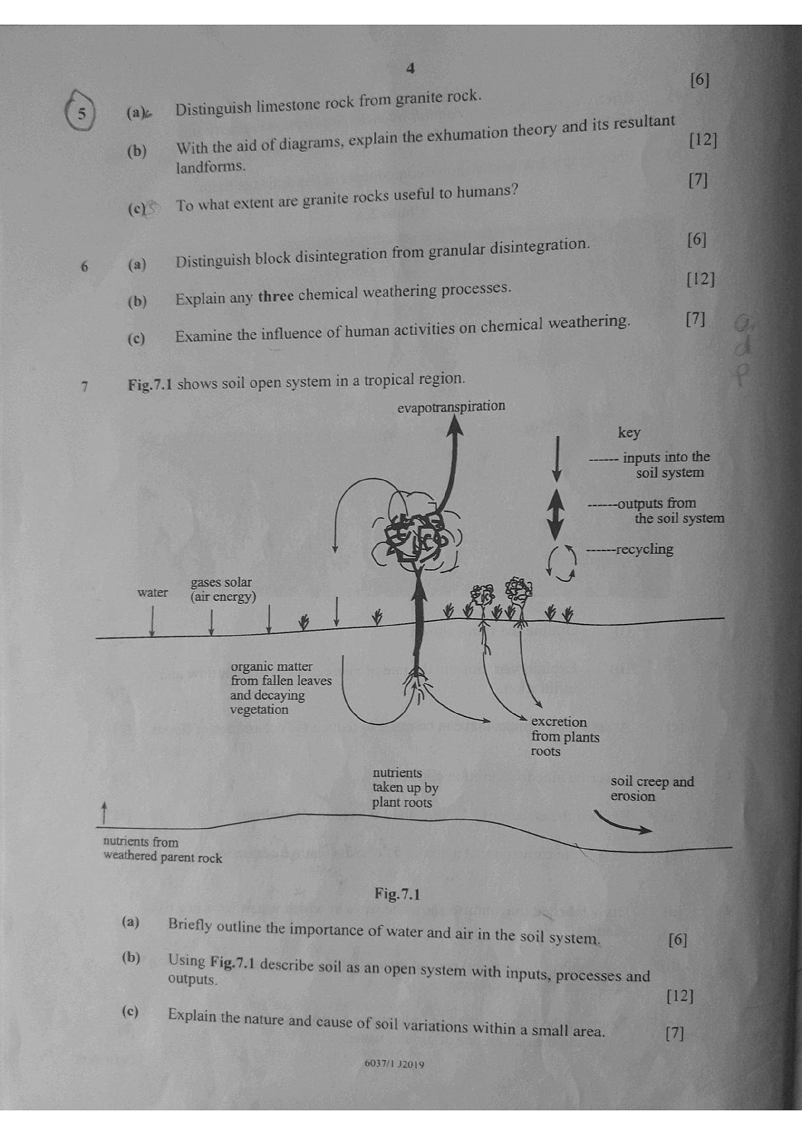
Fig.7.1 shows soil open system in a tropical region.
--—--outputs from
the soil
5 —--—-recycling
gases solar
water (air energy)
|
organic matter
from fallen leaves
and decaying
vegetation
excretion
ons plants
nutrients i
Satie soil creep and
plant roots a
nutrients from =
weathered parent rock
Fig.7.1
(a) —_ Briefl i i
mefly outline the importance of water and air in the soil syst [6]
; stem, 6]
(b) Using Fi i |
5 Fig.7.1 describe soi i
i ie ibe soil as an open system with inputs, processes and
(c) — Expla :
plain the nature and cause of soil variations within a small ar 7]
mall area.
4
Distinguish limestone rock from granite rock.
With the aid of diagrams, explain the exhumation theory and its resultant
landforms.
To what extent are granite rocks useful to humans?
Distinguish block disintegration from granular disintegration.
Explain any three chemical weathering processes. [1
Examine the influence of human activities on chemical weathering. (We
evapotranspiration
key 4
| _——— inputs into the 4
6037/1 12019
---
Page 5
Extracted Text
Is strea---
Struggling with the concepts in this paper?
Revise syllabus notes, key exam points, and interactive practice questions for Geography: