📄 Exam Questions & Readable Text Transcript
Full OCR-extracted text of questions, syllabus codes, and exam instructions.
Extracted Content: 2019_geo_olevel_nov_paper1
Page 1
Extracted Text
Per Prefarmency MenvorementZIMBABWE SCHOOL EXAMINATI
GEOGRAPHY
PAPER 1 Multiple Choice
NOVEMBER 2019 SESSION
1:50 000 Survey Map is enclosed with this question paper.
Additional materials:
Multiple Choice answer sheet
Soft clean eraser
Soft pencil (type B or HB is recommended)
TIME 1 hour 15 minutes
INSTRUCTIONS TO CANDIDATES
Do not open this booklet until you are told to do so.
provided unless this has already been done for you.
There are forty questions in this paper. Answer all questions. F
choice in soft pencil on the separate answer sheet.
Read very carefully the instructions on the answer sheet.
INFORMATION FOR CANDIDATES
Each correct answer will score one mark.
A mark will not be deducted for a wrong answer.
Any rough working should be done in this booklet. ,
General Certificate of Education Ordinary Level
Write your name, centre number and candidate number on the answer sheet in the spaces
four possible answers, A, B, C and D. Choose the one you consider correct and record your
ONS COUNCIL
4022/1
1 hour 15 minutes
or each question, there are
This question paper consists of 14 printed pages and 2 blank page(s).
Copyright: Zimbabwe School Examinations Coun!
noomencnee
@ZIMSEC N2019
cil, N2019.
[Turn over
Scanned with CamScanner
---
Page 2
Extracted Text
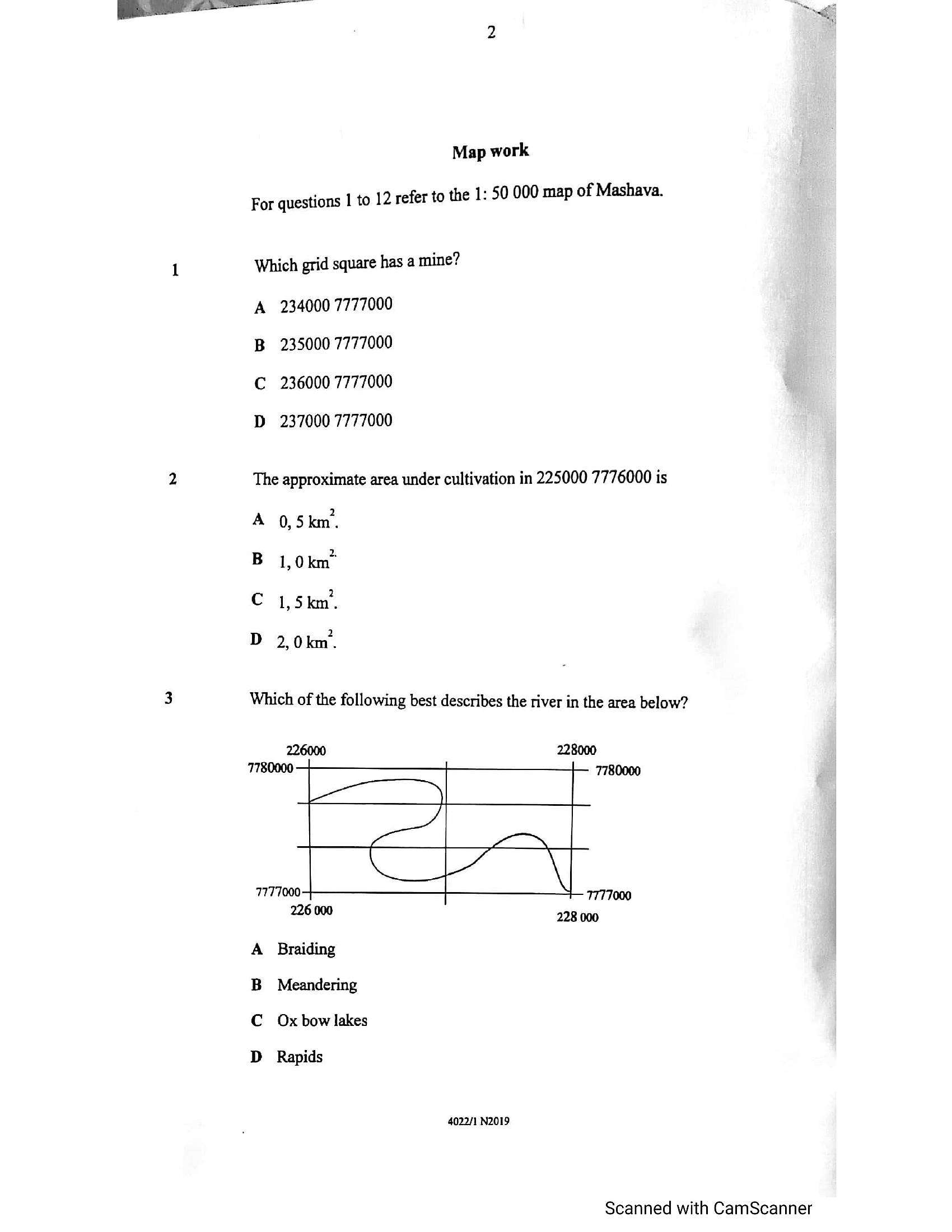
Map workFor questions | to 12 refer to the 1: 50 000 map of Mashava.
Which grid square has a mine?
A 234000 7777000
B 235000 7777000
C 236000 7777000
D 237000 7777000
The approximate area under cultivation in 225000 7776000 is
A 0,5km.
B 1,0km"
C 1,5km.
D 2,0km.
Which of the following best describes the river in the area below?
226000 228000
7780000 7780000
7777000 7777000
26000 228 000
A Braiding
B Meandering
C Oxbow lakes
D Rapids
4022/1 N2019
Scanned with CamScanner
---
Page 3
Extracted Text
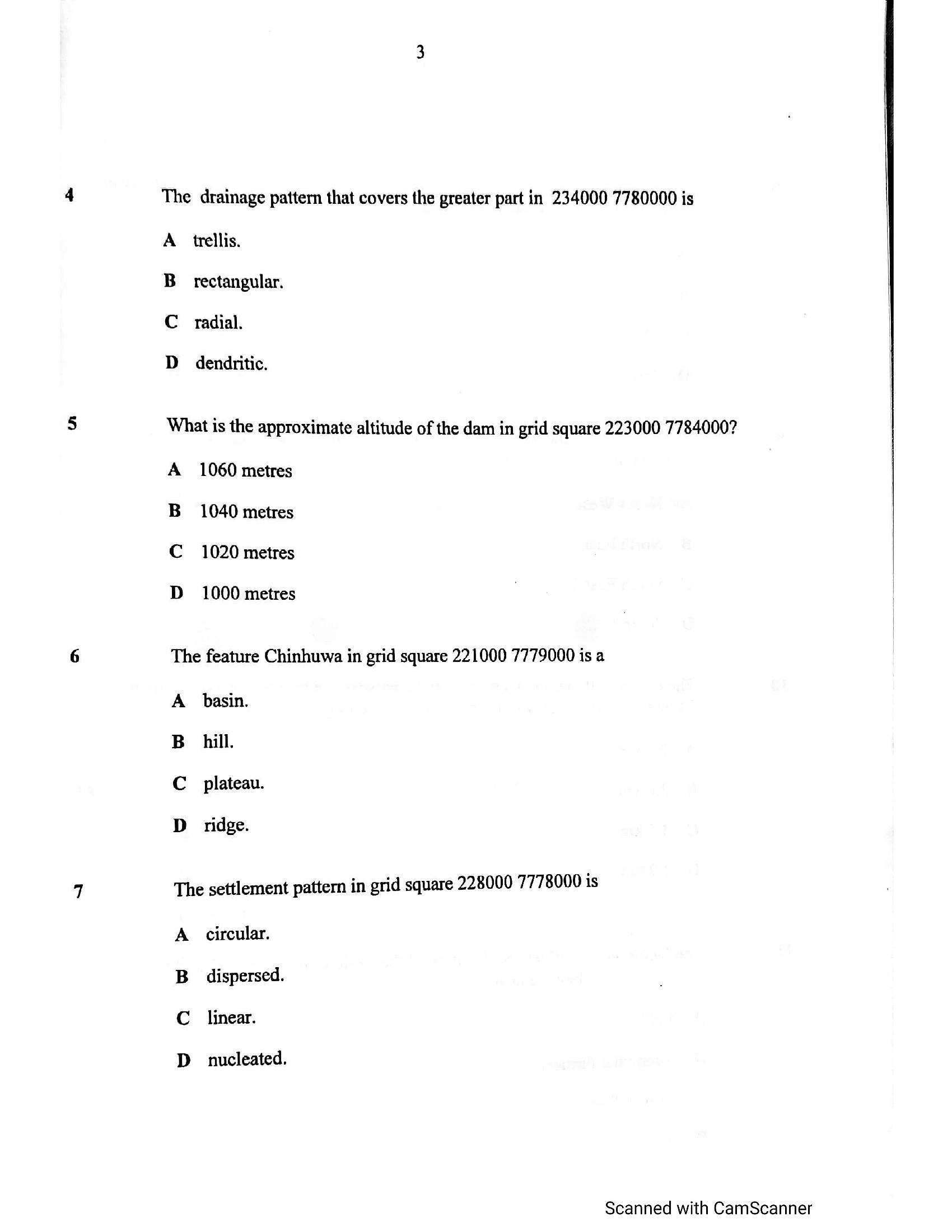
The drainage pattern that covers the greater part in 234000 7780000 isA
B
Cc
D
trellis.
rectangular.
radial.
dendritic.
What is the approximate altitude of the dam in grid square 223000 7784000?
A
B
Cc
D
1060 metres
1040 metres
1020 metres
1000 metres
The feature Chinhuwa in grid square 221000 7779000 is a
A
B
Cc
D
basin.
hill.
plateau.
ridge.
The settlement pattern in grid square 228000 7778000 is
A
B
Cc
D
circular.
dispersed.
linear.
nucleated.
Scanned with CamScanner
---
Page 4
Extracted Text
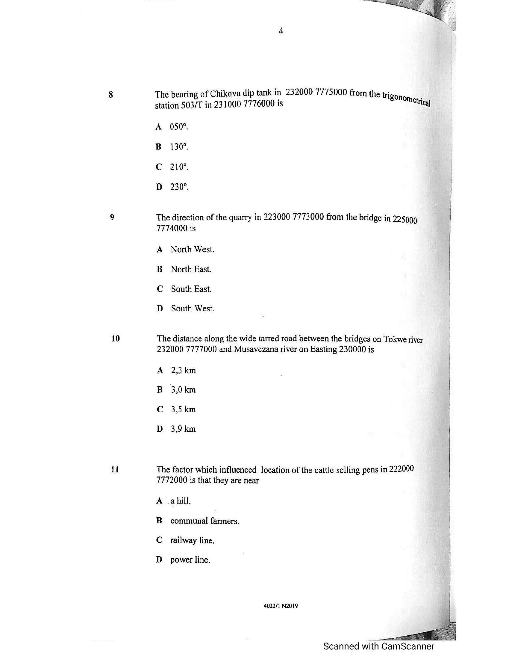
ilThe bearing of Chikova dip tank in 232000 7775000 from the tri
station 503/T in 231000 7776000 is
A
B
Cc
D
Bonometrigy
050°.
130°.
210°.
230°.
The direction of the quarry in 223000 7773000 from the bridge in 225009
7774000 is
A
B
Cc
D
North West.
North East.
South East.
South West.
The distance along the wide tarred road between the bridges on Tokwe river
232000 7777000 and Musavezana river on Easting 230000 is
A
B
Cc
D
2,3 km
3,0 km
3,5 km
3,9 km
The factor which influenced location of the cattle selling pens in 222000
7772000 is that they are near
A
B
Cc
D
a hill.
communal farmers.
railway line.
power line.
4022/1 N2019
Scanned with CamScanner
---
Page 5
Extracted Text
1213
14
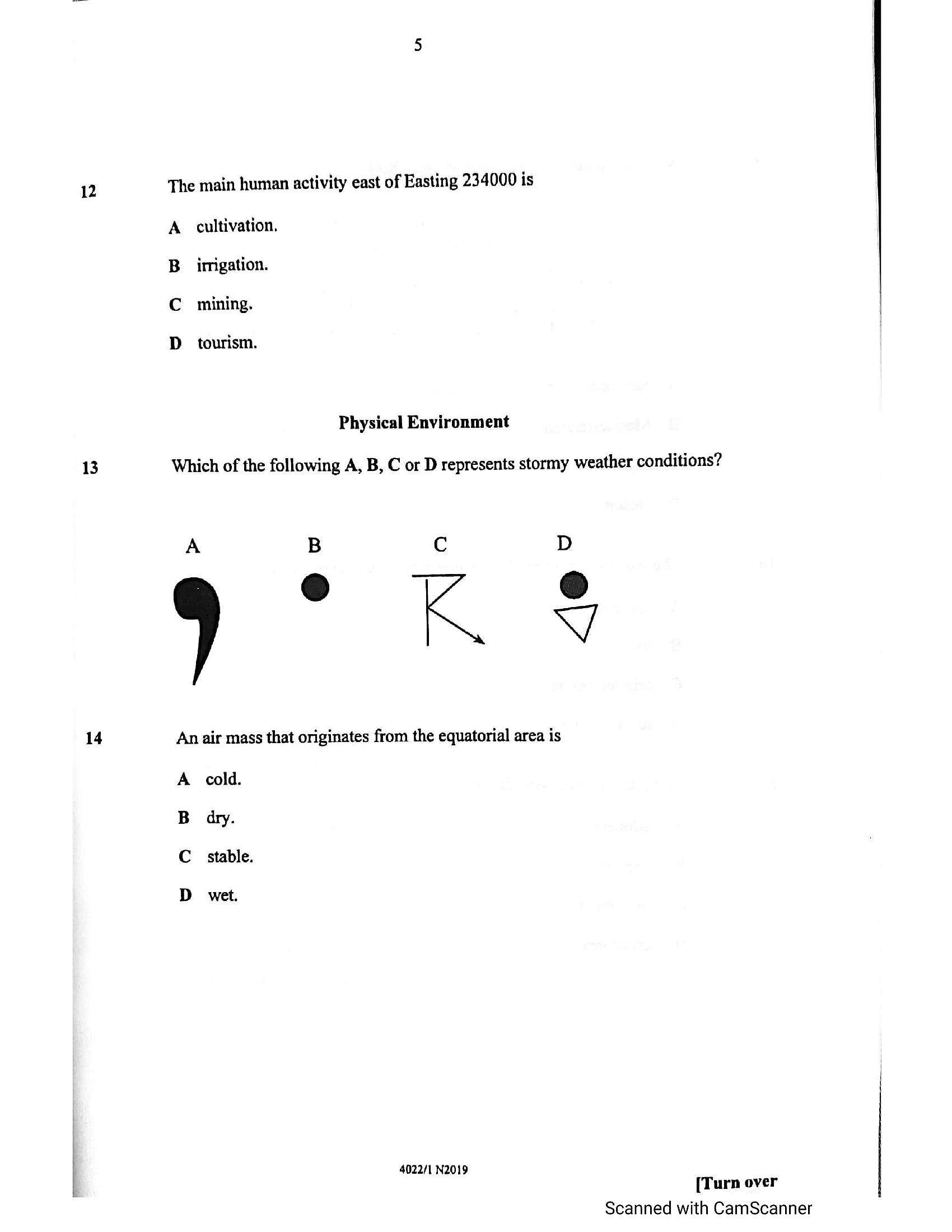
The main human activity east of Easting 234000 is
A. cultivation.
irrigation.
mining.
3s 0 @
tourism.
Physical Environment
Which of the following A, B, C or D represents stormy weather conditions?
A B C
0 e
V/
An air mass that originates from the equatorial area is
A cold.
dry.
stable.
sos a US
wet.
4022/1 N2019
[Turn over
Scanned with CamScanner
---
Page 6
Extracted Text
1516
17
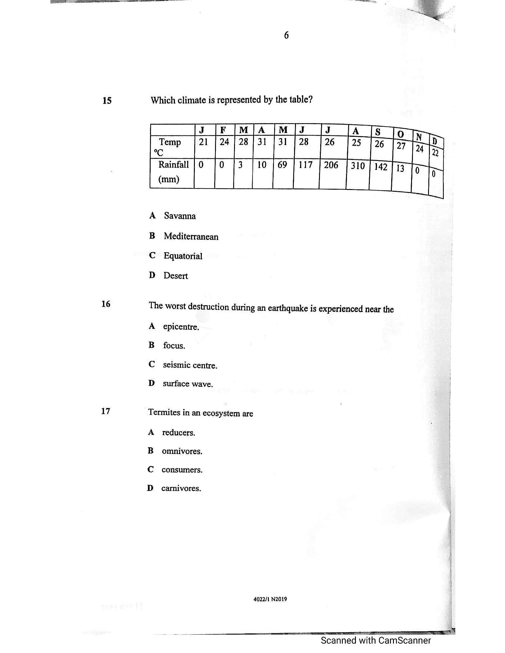
Which climate is represented by the table?
A Savanna
B Mediterranean
C_ Equatorial
D Desert
The worst destruction during an earthquake is experienced near the
A epicentre,
w
focus.
a
seismic centre.
i]
surface wave,
Termites in an ecosystem are
A reducers. }
omnivores.
B
C consumers.
D carnivores.
4022/1 N2019
Scanned with CamScanner
---
Page 7
Extracted Text
18 A B Cc D19
A
B
c
D
20
A
B
c
D
21
A
B
Cc
D
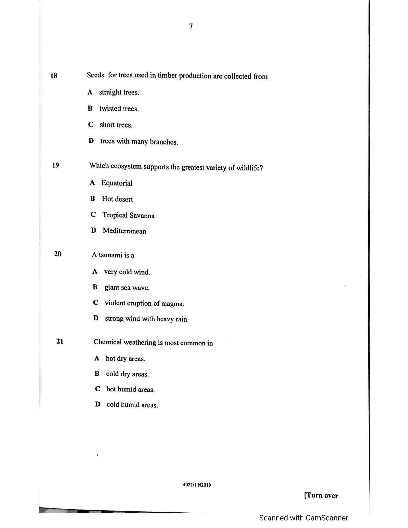
Seeds for trees used in timber production are collected from
straight trees,
twisted trees,
short trees,
trees with many branches.
Which ecosystem supports the greatest variety of wildlife?
Equatorial
Hot desert
Tropical Savanna
Mediterranean
A tsunami is a
very cold wind.
giant sea wave.
violent eruption of magma.
strong wind with heavy rain.
Chemical weathering is most common in
hot dry areas.
cold dry areas.
hot humid areas,
cold humid areas.
4022/1 N2019
[Turn over
Scanned with CamScanner
---
Page 8
Extracted Text
2223
24
25
The best action to take when approaching a flooded river is
A crossing on a narrow section.
Busing dug out canoes.
C_ waiting until river subsides.
D crossing in a car.
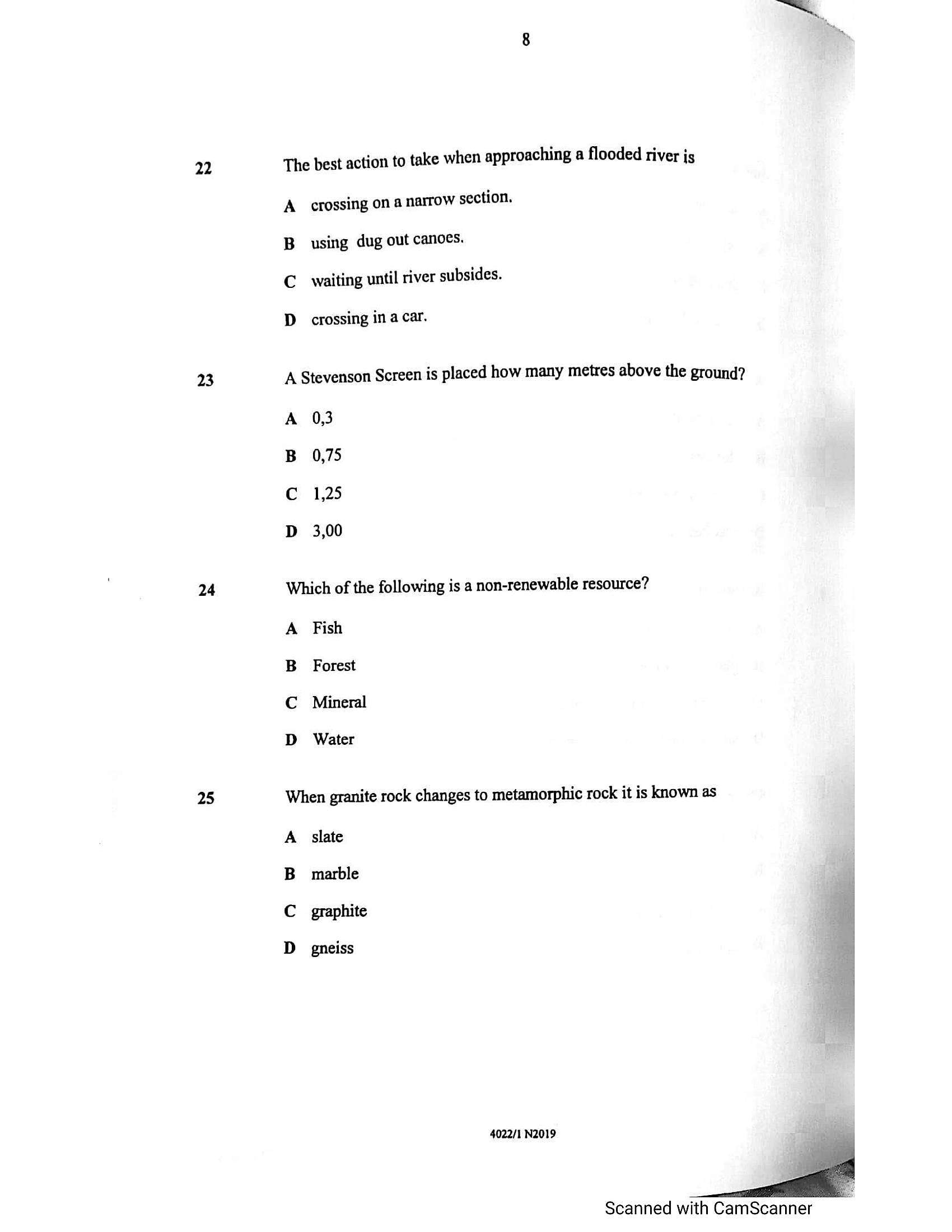
A Stevenson Screen is placed how many metres above the ground?
A 0,3
B 0,75
C 1,25
D 3,00
Which of the following is a non-renewable resource?
A Fish
B Forest
C Mineral
D
Water
When granite rock changes to metamorphic rock it is known as
A. slate
B_ marble
C graphite
D gneiss
4022/1 N2019
Scanned with CamScanner
---
Page 9
Extracted Text
2627
28
29
Economic Geography
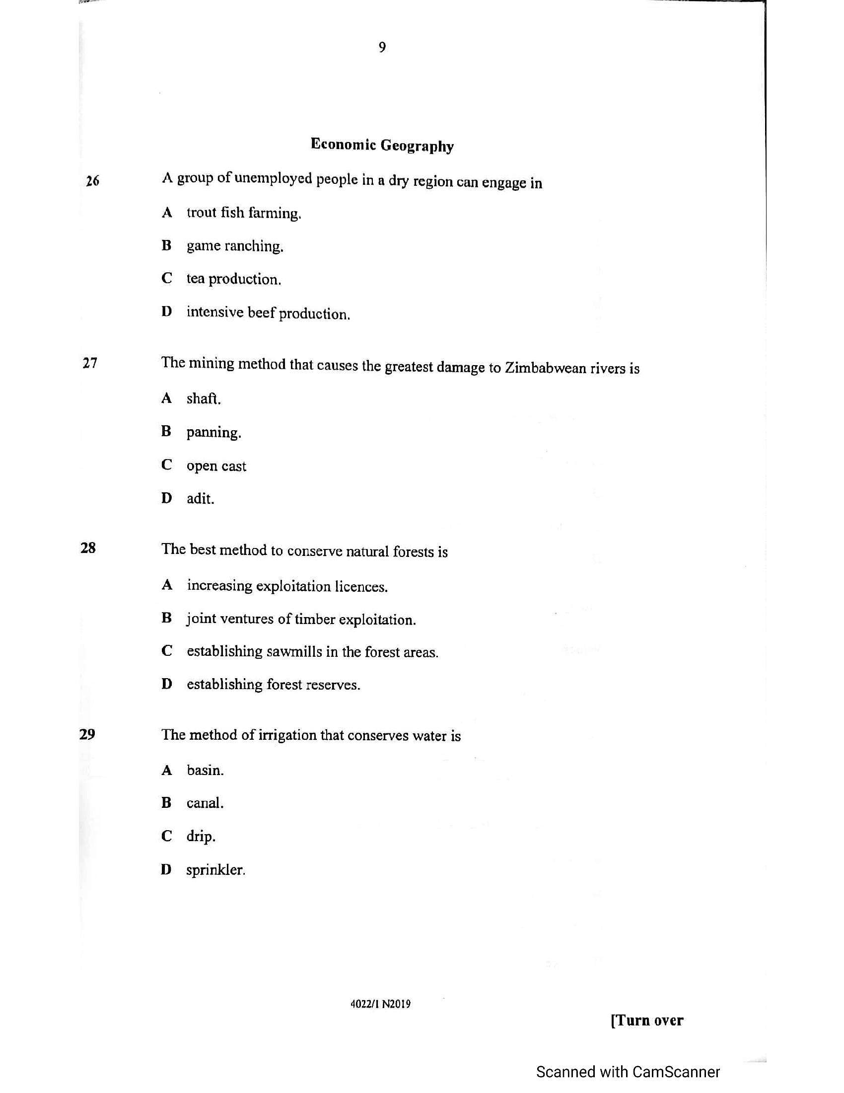
A group of unemployed people in a dry region can engage in
A
B
Cc
D
trout fish farming.
game ranching.
tea production.
intensive beef production.
The mining method that causes the greatest damage to Zimbabwean rivers is
A
B
c
D
shaft.
panning.
open cast
adit.
The best method to conserve natural forests is
A
B
c
D
increasing exploitation licences.
joint ventures of timber exploitation.
establishing sawmills in the forest areas.
establishing forest reserves.
The method of irrigation that conserves water is
A
B
basin.
canal.
drip.
sprinkler.
4022/1 N2019
[Turn over
Scanned with CamScanner
---
Page 10
Extracted Text
3031
32
nt WE a eh
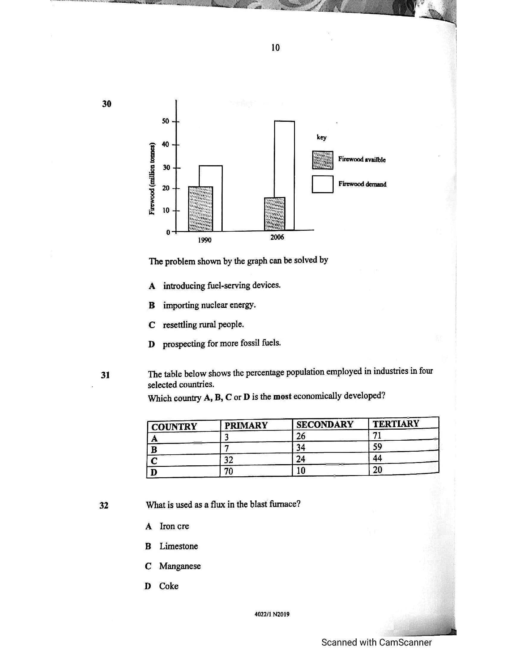
10
Firewood availble
[| Firewood demand
2006
The problem shown by the graph can be solved by
A introducing fuel-serving devices.
B importing nuclear energy.
C._resettling rural people.
D prospecting for more fossil fuels.
The table below shows the percentage population employed in industries in four
selected countries.
Which country A, B, C or D is the most economically developed?
COUNTRY _| PRIMARY SECONDARY _| TERTIARY
A 3 26 [7
a Fy
a
What is used as a flux in the blast furnace?
A Ironcre
B_ Limestone
C Manganese
D_ Coke
4022/1 N2019
Scanned with CamScanner
---
Page 11
Extracted Text
1]33
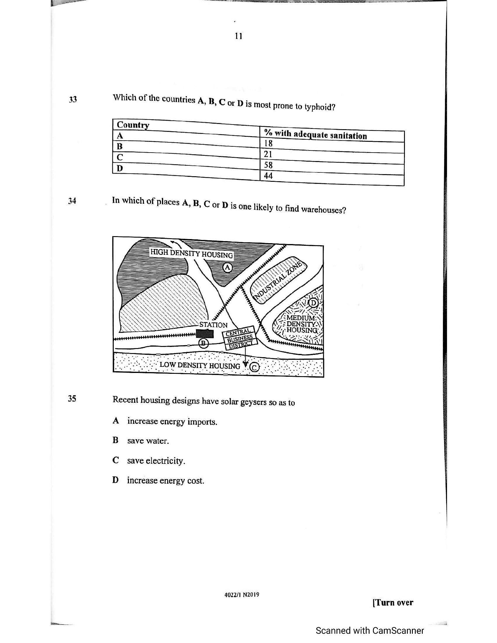
34 In which of places A,B, Cor Dis one likely to find warehouses?
35 Recent housing designs have solar geysers so as to
A increase energy imports.
B save water.
C save electricity.
D increase energy cost.
4022/1 N2019 r er
urn ov
Scanned with CamScanner
---
Page 12
Extracted Text
3637
Population, Settlement, Environment, Transport and T rade
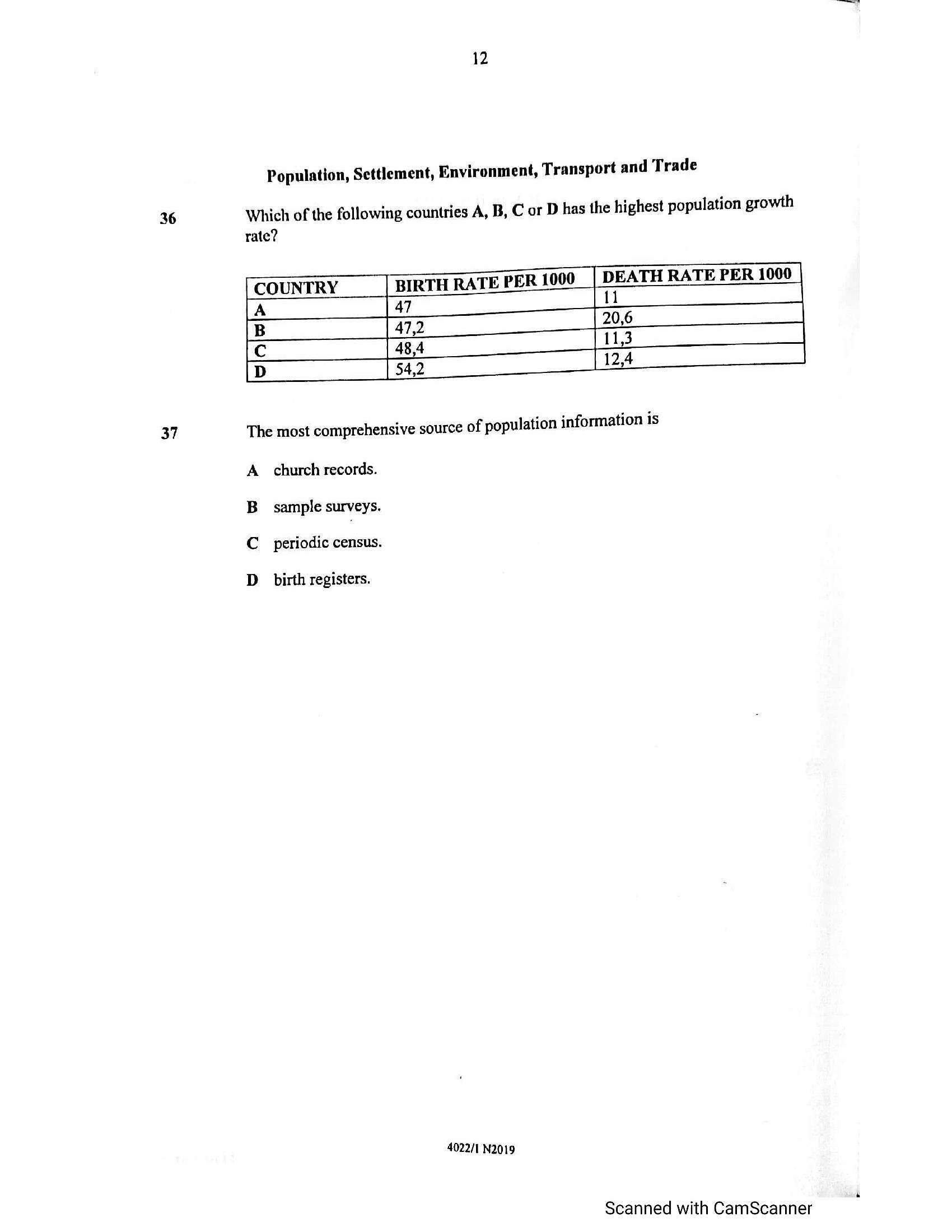
Which of the following countries A, B, C or D has the highest population growth
rate?
BIRTH RATE PER 1000 DEATH RATE PER 1000
47
[ COUNTRY
[A
pulation information is
The most comprehensive source of po}
A church records.
B_ssample surveys.
C_ periodic census.
D
birth registers.
4022/1 N2019
Scanned with CamScanner
---
Page 13
Extracted Text
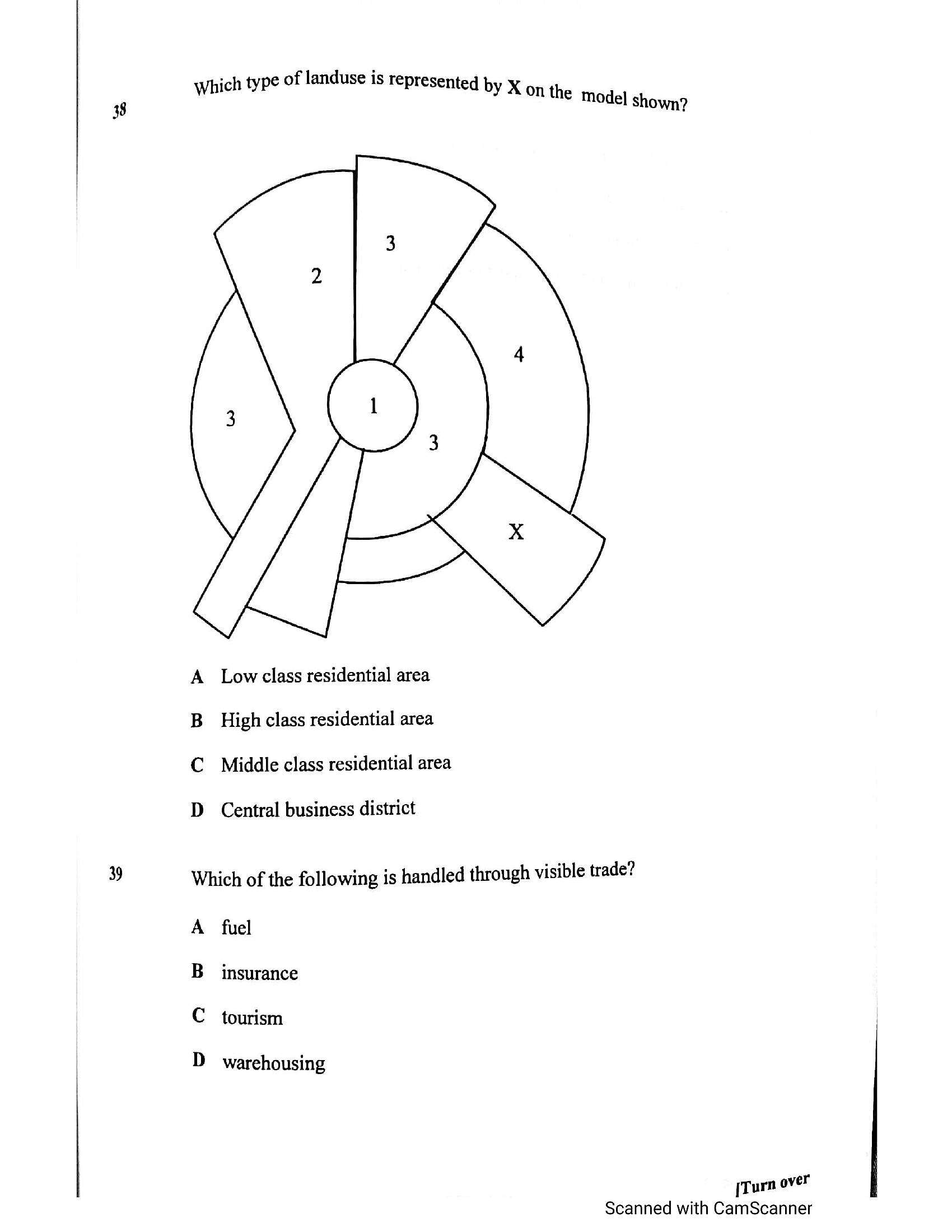
which type of landuse is represented by x 8 Y A on the Model shown?—_
A Lowclass residential area
B_ High class residential area
C Middle class residential area
D Central business district
9 Which of the following is handled through visible trade?
A fuel
B insurance
C tourism
D
warehousing
[Turn over
Scanned with CamScanner
---
Page 14
Extracted Text
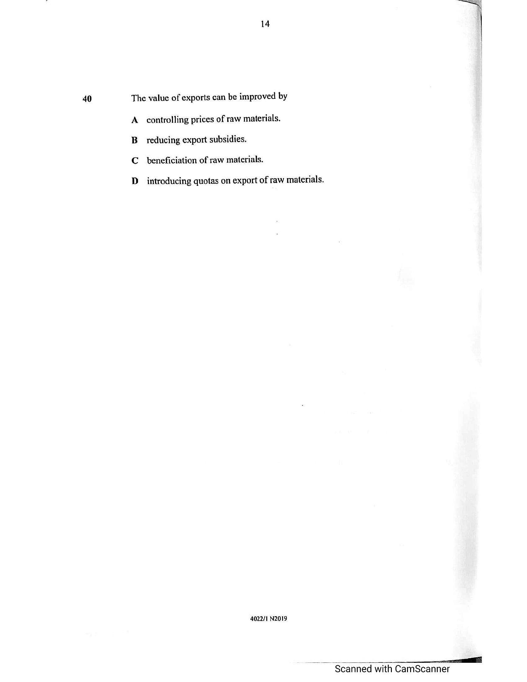
40The value of exports can be improved by
A. controlling prices of raw materials.
B_ reducing export subsidies.
C_ beneficiation of raw materials.
D_ introducing quotas on export of raw materials.
4022/1 N2019
i
Scanned with CamScanner
---
Struggling with the concepts in this paper?
Revise syllabus notes, key exam points, and interactive practice questions for Geography: